 View all instruments of this unit
 3D Laserscanning Multistation Leica Geosystems Leica Nova MS60 MultiStation
Basic Information
| Name: | 3D Laserscanning Multistation | |
| Manufacturer: | Leica Geosystems | |
| Model: | Leica Nova MS60 MultiStation | |
| Facility: | Chair of Photogrammetry | |
| Partner: | Technische Universität Dresden (TUD) |
|
Short Description
"The world’s first self-learning MultiStation automatically adjusts to any environment, regardless of the challenges." [http://leica-geosystems.com]
Description
"The world’s first self-learning MultiStation automatically adjusts to any environment, regardless of the challenges." [http://leica-geosystems.com]
Technical Details:
- Measurement Range: up to 1000 m
- Accuracy: 1 mm
- 1000 Points/s up to 300 m
Link to Further Details
http://leica-geosystems.com/de-de/products/total-stations/multistation/leica-nova-ms60
Points of Contact
Images
| Preview | Description |
|---|---|
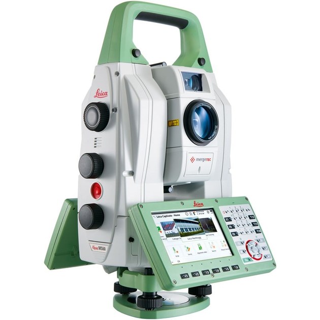
Source: http://leica-geosystems.com |
3D Laser Scanner Leica Nova MS60 MultiStation |
Last Update
Last updated at: 8 October 2018 at 11:18:11